|
After a short 150m walk from the parking the trail enters a grassy clearing. From here there are three options: the path to your right and the one straight ahead form a loop. The path to your left skirts the edge of the property and eventually comes to a dead end.
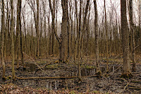
The loop path circles a dense swamp with numerous wet and muddy area to cross. The flora varies from deciduous near the northern part of the loop to a pine plantation in the NW and a thick cedar forest where the path gets close to the wetland. Elevation changes are minimal.
|
|
The dead end path is much drier and follows the southern edge of the property. There is a hill on this section that must be climbed (both directions) that might cause some distress, but there are some pleasant views of the surrounding forest. The trail borders some backyards for part of the route.
The loop section is almost exactly 1.0km, the dead end trail is 570m (1.4km return). If all paths are walked the total will be approximately 2.5km.
View Larger Map


No comments:
Post a Comment